Attration Category
Liu'an Weather

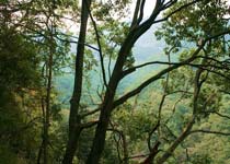
Dabie Mountains (Luan) National Geological Park runs through eastern China, located in Hubei, Henan and Anhui provinces at the junction of what the Dabie pulse stretching about 380 km north-south width of 175 km, as a natural barrier, the two major river systems of the Yangtze River and Huaihe River watershed.
Dabie Mountain (Lu';an) National Geopark in Anhui Province in the west, west Henan, and Hubei at the junction of the South. Dabie Mountains (Luan) wider range of geological park, the park more, according to the distribution of the various parks and geological features of the park will be divided into western and eastern park.
West Park is located in the Dabie Mountains abdomen, as inMountains. Including Tiantangzhai Park, Tongluozhai Park, Red Rock Valley Park, Swallow Creek Park and the white tip of the Grand Canyon Park.
Park is located in the eastern Dabie Mountains, the hilly area. Including the Buddha Park Ridge, East stalagmites Park, Ten Thousand Buddhas Lake Park, West Anhui Great Rift Valley Park and Song Liao Rock Park.
Dabie Mountains (Luan) National Geological Park is one of the few sets of granite landforms, rocks landscape, landform, tectonic geomorphology and volcanic landscape as an integrated park. White Horse sharp peak elevation of 1774 meters, is the first peak in the Dabie Mountains, located in the white tip of the park, neighboring Longjing RiverGrand Canyon. Tiantangzhai peak elevation of 1729.1 meters, is the second peak of the Dabie Mountains, located in Tiantangzhai Park.


