Attration Category

Tourist guide
Into the Dulong';s Road is a pass just near the township road repair and road to reach the township government is over, you want to truly enter into the Dulong settlements, but also a long walk, and they lived more scattered. In the process of Dulongjiang hiking, walking 15 kilometers a day or more, of physical strength, perseverance in all aspects is a great test, need to think carefully before traveling.
Dulong Section Main Line: hangingBridge (right bank) iron wooden horse library hymns Qinlang down when summit pillar (Yakou fork in the road turn right) library Ma Bridge Suspension Bridge hole when the bamboo cane. According to information provided by Tourism Bureau Gongshan: Gongshan - the Qi of 17 kilometers, the Chi - 13 km east post room, post the East Room - Tamagnini 30 km, Pakistan Singapore - Maku 22 km, horse library - Falls 8 km, Pakistan Singapore - hole when the 18 km, the entire 138 km.
Introduction
This is a remote and mysterious valley, located in northwest Yunnan Lisu from the Nu RiverRule states, Dulong and Nu Autonomous County, the highest altitude of 4963 meters Valley, the lowest elevation of 1,000 meters. Each year in November, the Dulong River Valley lost almost all contact with the outside world, ten meters of snow are blocking everything in the snow outside the residence, only the arrival of snow and ice melt in August when the valley is the most popular season.
Dulong Chayu originated in Yunnan, 150 km from north to south winds, the average width of the river about 40 meters on both sides of the Dulong Village people "far shore, hear conversations, meet for three days to go shake hands," This is not an exaggeration Some places even have ten days to goDifficult to shake hands. And river rapids, reefs crosswise, Ferry is not possible, so people just "flying" over canyons, to keep the link between the two sides must.
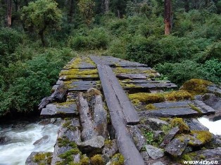
Dulong people who really can "fly" through valleys, but there are many "fly" method: the first one known as the bridge and back no matter how much Dulong, day or night can be from the "bridge" flying across the river, action light, Rulvpingdi. Another way is to cross the river Liusuo. In fact, both take the suspension or Liusuo are veryDangerous, but the power of the independent living of people trained in a special long, so along the Dulong River travel, one is to look at the river Dulong people can feel great satisfaction.
Special note: the end of October each year to the next year by the end of April snow closing, 5 ~ 8 month rainy season, poor road conditions, more dangerous. Proposed to enter in the fall, that season is the best climate and landscape. Mountain weather is changeable, please be careful. Local pronunciation of place names in accordance with the individual record. Would be best to do a local guide familiar with the situation. Into the Piedmont, Bureau of Forestry in advance to handle the relevant procedures Gongshan. In addition, the process of Dulongjiang hiking, walking 15 kilometers a day for more than physical strength, perseverance in all aspects is a great test, need to think carefully before traveling. Most of the local camping accommodation or living village hall. In addition, the Nu River valley weather changing, temperature difference between day and night to keep warm. Of course, with good common drugs is necessary.
TrafficFrom QueenslandMing travel to six libraries (Nu state capital), the entire 614 km, 3-5 classes a day sleeper buses, fares 90-130 yuan, take 16 hours to reach the six libraries, the need to re-Dealers 280 kilometers to get to the Dagon Hill. Gongshan Dulongjiang walking distance from the local mountain is very steep, difficulty walking, can be back on behalf of a local porters carry luggage, reduce their burden.
